Tuesday, December 21, 2010

Nett Point

Location: Nett
Difficulty: Easy
Length: Varies
Cost: None
Watch out for: Nasty water on the right of the pier

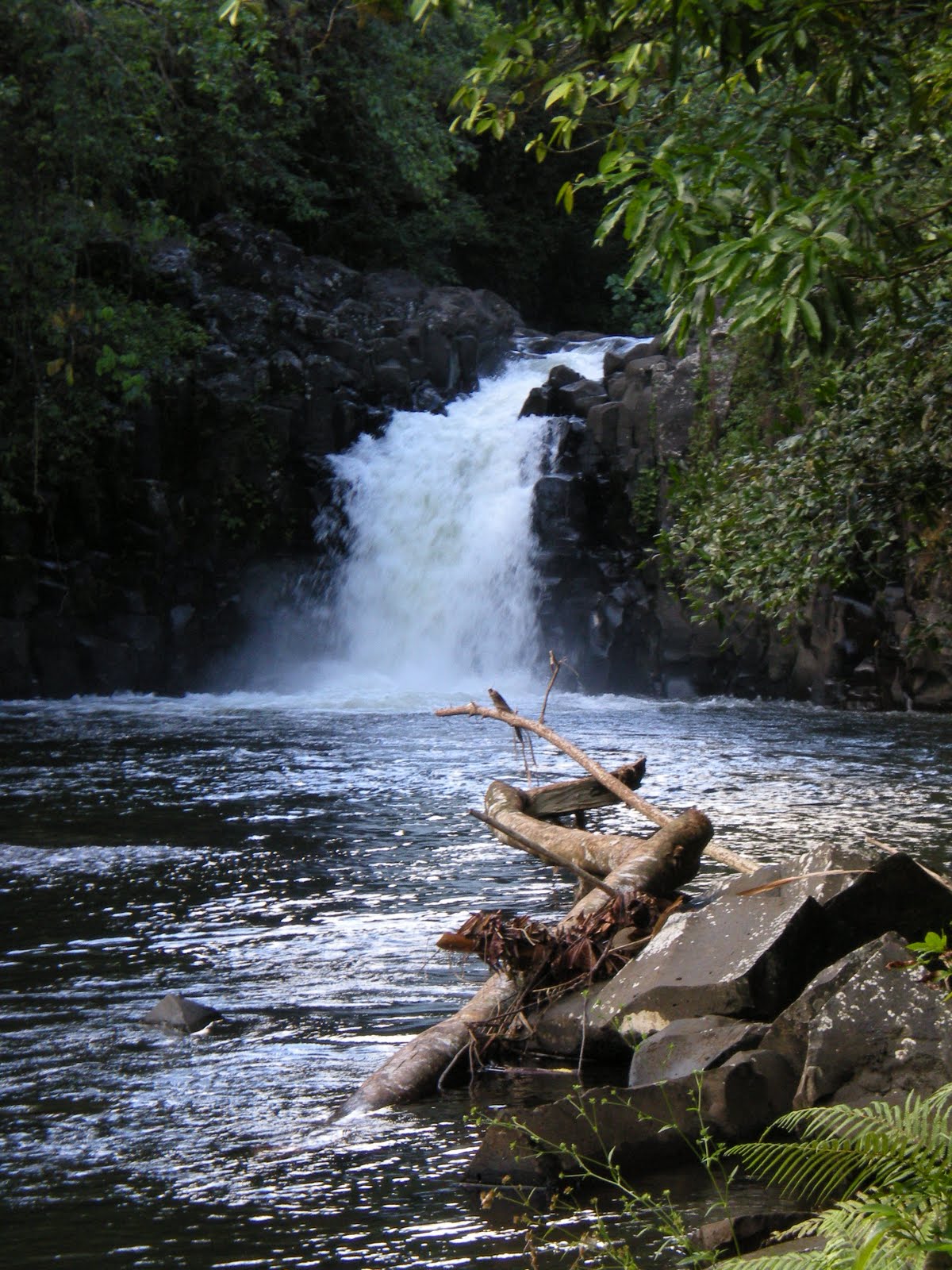
Description: Nett Point is a popular place to picnic and swim, and can be a great walk if you're looking for an easier stroll. The hike can either be an out-and-back route along one of the two roads that leads to the point, or can be taken as a longer loop trail. Alternatively, you can also drive to the point if you're looking for more of a picnic or swim site than a workout. When you're at the point, swim to the left side where the water is cleaner.


Directions: Coming from Kolonia, head toward Nett/Madolenihmw. Just after crossing the bridge, turn left and follow this road out to the point. The second road that leads to the point will meet up with the first one close to the end. If you follow the 'back road' back from Nett Point, it will take you farther down the island road. When you get to the island road from the back road, just turn right to find your way back to the bridge and to Kolonia.


**With great thanks to Ecky and Sam Upritchard for the photos!**

Tuesday, November 16, 2010

Louran

Location: Nett
Difficulty: Difficult
Length: 3 hours
Cost: $3/person for the guide
Watch out for: Lots of loose rocks at the top, lots of sakau along the trail

Description: This is an uncommon hike up to some stunning rocks in Nett. The area features small waterfalls and WWII guns, as well as the rock face and cave outlook pictured. The path scrambles up through overgrown jungle before reaching an open rocky base of a tall but thin waterfall.

If desired, you can continue a small portion longer (through the waterfall and over treacherous footing - be careful) to find a bat cave. If you pass through the bat cave you'll find an amazing view of Kolonia and Sokeh's Rock.


Directions: Arrange for a guide with Rico Rico (922-1596), and meet up with him somewhere in Nett. Take the road out of Kolonia towards Awak, but turn right at the Nett government building - the road just before the bridge.


Pahn Sile

Location: Madolenihmw
Difficulty: Easy-Moderate
Length: 1 hour round trip, not including swimming
Cost: $50 total (1-11 people), $75 total (12-20 people)
Watch out for: Slick footing during and next to river crossings, rocks under the waterfall

Description: This is a nice, short hike to a beautiful waterfall. The trail is relatively simple, and only earns the moderate addition for one small stream crossing over a log, and a couple river crossings. Your feet will get wet, so choose shoes accordingly.

There is a large pool for swimming, and the chance to scramble a bit on the rocks to the right. There are sizable rocks under the fall, though, so use caution if jumping in.

Directions: You can arrange for a guide by calling Joseph Rosario (work: Parks and Tourism Office, home 320-6434). He will meet you across from the new Mormon church in Madolenihmw and drive the rest with you. You will turn to the right and follow a dirt road until the end before starting the hike. If possible, I suggest parking earlier on the road and walking a bit - the road can be very rough in patches, and a longer hike may be desirable.


Six Waterfalls

Location: Kitti
Difficulty: Strenuous
Length: 5-7 hours
Cost: $20/person if five or more, more for smaller groups
Watch out for: Too much rain can make parts of hike impossible. Be careful of flash floods.

Description: This is a long, beautiful hike through the waterfalls of Salapwuk, Kitti. The trail is like a teardrop in shape, so you'll start and end on the same path, but have a circular route in the middle. The path is often very muddy and rocky, and involves wading through rivers. You will get very wet, so choose shoes carefully and protect valuables in waterproof bags.


There are six waterfalls to see, each spectacular. You can swim and dive in most of them, and your guides will give you plenty of time to enjoy each. After reaching the first fall, you'll find that two and three are close by. A short hike will eventually bring you to four and five. Getting to the last waterfall requires a swim upstream. If you want your bag with you, your obliging guide will bring it for you along a more difficult, but dry route.

Heading back, you will likely climb up, up up, until returning to the path where you started.

Directions: You'll need to arrange for a guide. You can contact the Peace Corps volunteer in Salapwuk, or call the Peace Corps office at 320-2531 and speak to Kikulynn Hebel. To get to the start of the hike, take the Island Circle road towards Kitti. Just after the very terraced house and before you get to the turn for the Nahlap dock, turn left at the street pictured below. Follow this road until it turns to dirt, and park on the right side of the road. Continue along the dirt road until you reach the elementary school, and you will meet your guides there.


Sunday, October 24, 2010

Kupwuriso

Location: U
Difficulty: Strenuous
Length: 5 hours+
Cost: $5 for guide
Watch out for: Sheer drops at viewpoints

Description: This hike follows a well travelled path up to the top of the mountain above Pahn Tikai. It's a high peak and offers spectacular views, several WWII bunkers and guns, and beautiful mossy growth. Its a long hike, but isn't terribly technical. There are a few steep points, but most of the path follows the old 'road' used to move equipment to the top during the war. Along the way there are many points of interest, including a meadow, an overlook of Nett, a communication pipe, a crater left behind by an Allied strike, an overlook of the two islands of U, and an overlook of Madolenihmw.

You can arrange a guide through the Conservation Society of Pohnpei by calling their office.

Directions: Leaving Kolonia town, take the island circle road towards Madolenihmw. The hike should start somewhere between the Catholic church on the right at the road leading to Pahn Tikai. Arrange a meeting place with your guide and he will show you where to park.

Sokeh's Ridge (Pohndollap)

Location: Sokeh's Island
Difficulty: Moderate
Length: 1.5 hours, not including exploring
Cost: None
Watch out for: Dogs on the road and slick rocks

Description
: The ridge is a very convenient hike for people in Kolonia. It's walkable from anywhere in town and offers both a good workout and a good view. You'll walk along a paved road, then along a dirt road, and come to a first scenic overlook. This is a good place to stop if you're looking for a very easy trip, but if you continue up up up you'll have even better views.

Following the steep section after the first overlook, the trail will head to your right, becoming very flat for a while. If you walk straight past a small building instead of following the trail to the right, there are at least two WWII-era guns and bunkers to visit. Following the trail will lead you to a final steep push, at the end of which you'll find a weather station platform and a nice view of Kolonia town and the airport.

Directions: Heading out of Kolonia towards Palikir, stay straight after the Rusty Anchor to cross onto Sokeh's Island. The trail to the ridge is up the road going straight - don't turn left or right at the intersection. You can park at the community center just to your right after the intersection or drive up as far as you like. Be sure to ask if parking in front of someone's house is ok.

Sunday, October 17, 2010

Dolin Eirike (Triangle Mountain)

Location: Nett
Difficulty: Strenuous
Length: 5 hours
Cost: $3 for a guide, if desired
Watch out for: Technical footing and hidden trenches at the top

Description: This hike climbs to the top of the triangle-shaped mountain in Nett that is visible from Kolonia. Though not required, a guide is recommended. (You can get in touch with our most recent guide, Rico Rico, by contacting Dennis, Delyla, or Emily for his phone number). The path is well-defined for a while, but will take a turn towards a more rough trail to the left. The path is rocky and at parts eroding, so wear appropriate footwear.

The top of the mountain has an overgrown view of Sokehs Rock and the reef, but more interesting are deep trenches remaining from WWII - hideouts for Japanese soldiers during bombing raids. You can walk along the ridge a ways, but the view remains overgrown.

Directions: From Kolonia, take the island-circle road towards Nett. Just before the bridge crossing the river, turn right at the Nett Government building. Follow this road until you have an opportunity to stay to the right, and keep driving. You will pass a narrow bridge and continue on up hill. Follow the road as long as you can, until the pavement ends. You should see a house similar to the one below on your left. The trail starts directly ahead of you.

Saturday, October 16, 2010

Liduduhniap Waterfall

Location: Nett
Difficulty: Easy
Length: 15-20 minutes
Cost: $1 (you may be charged more if you are carrying a camera)
Watch out for: Flash floods

Description: This is a very easy double waterfall just outside of Kolonia. The walk is along a road the entire way, and with the exception of a couple steeper points, is very easy. To make it more of a workout, park farther down the road. To make it a quicker trip, park closer to the fall.

The top fall has a good 20-foot jump from the side. Once you're in the water, there's a cave to explore, or a fallen tree trunk to climb on. When you're ready to return to the top, exit the water on the opposite side. There's a path up to the top through the jungle, and you'll cross back over the river just before the waterfall.

The second fall is much taller, and there are too many rocks at the bottom for jumping. Its a great pool for swimming.

For both falls, be careful of flash flooding. If the water is particularly gushing or is filled with leaves and debris from up-river, don't swim. The statue at the top of the path commemorates a handful of athletes drowned in a flash flood some years ago.

Directions: From Kolonia, take the island-circle road towards Nett. Just before Genesis hospital, turn right at the sign pointing to Liduduhniap Falls. Follow this road past the jail, past a rough stretch, until you come to an old hydroelectric plant. You can park at the plant and walk 15 minutes to the falls, or continue to drive up (if your car can handle the road). When you come to a fork in the road, turn left, and continue until you come to a house on the right. Pay at the house (pictured below) and then follow the trail starting on the left side of the street, to the right of the statue.

Thursday, October 14, 2010

Lehn Paipohn Waterfall

Location: Kitti
Difficulty: Easy-Moderate
Length: 2 hours, plus swimming time
Cost: None
Watch out for: Strong current and rocks when jumping in

Description: This hike follows a rough dirt road for a long portion. You can park along the island-circle road or follow the dirt road as long as your car will allow. From the island-circle road, follow the paved road past a few houses and a church, and then stay straight to follow the rough dirt road. Follow this road approximately 30 minutes. You will pass a house on your right with a pipe spraying water. Shortly after the house, you will turn left, following a trail under low curved branches (see image below).

Follow this well-marked path through the jungle for another 30 minutes. You will pass a building and cross a stream, and will find your way to a view of the waterfall below you. Turn left to follow a path down to the water. If you decide to jump from above, be very careful of the strong current and of possible rocks beneath you. Follow the same path back.

Directions: From Kolonia, take the island-circle road towards Kitti. Pass the turn for Palikir, COM, and the docks for both Black Coral and Nahlap. There will be a turn to the left shortly after the Nahlap dock (pictures coming soon). You can park at the store, or in front of the World Teach volunteer house on the left just after the turn. If you pass NMHS, the high school in Kitti, you've just passed the turn.

[Image of parking site]
[Image of turn from trail]

Sokeh's Rock (Paipalap)

Location: Sokeh's Island
Difficulty: Difficult
Length: 1.5 hours, plus time to explore the top
Cost: None
Watch out for: Rain - this is a dry weather only hike
Description: Climb to the top of Pohnpei's most famous landmark, Sokeh's Rock. This is a hike that is half jungle, half rock-climb. The trail starts from the Sokehs-island-circle road and climbs rather quickly up through the jungle. Its a good idea to warm up by parking at the elementary school and walking a short distance before starting the climb. The path through the jungle is well-marked. Continue until you come to a tree tied with ropes headed to your right.


Climb the ropes to scale across several tree roots until you come to a pipe leading up. Follow the pipe, using the rope and footholds to assist you. When you get to the top of this portion, you will see a long pipe and a rope leading up to the top of the Rock. Climb away - there are plenty of footholds, so take the time needed to find secure footing.

At the top, walk through the low bushes, pineapple plants, and a small group of trees to find the exposed rock surface. Enjoy the view! The way down is the same as the way up.

Directions: From Kolonia, pass the Rusty Anchor on the way out of town towards Kitti. Instead of turning left to climb up past the big Mormon complex, stay straight and cross the bridge onto Sokeh's Island. Turn right at the fork, and follow along until you find an elementary school on the right. Park here, and walk along the road for about ten minutes until you see the stairs that start the trail on the left side of the road (pictured below).


Two Islands of Uh

Location: Uh
Difficulty: Moderate
Length: 4 hours (10 miles)
Cost: None
Watch out for: Dogs, and the tide - towards the end of your hike, a high tide can have you walking through ankle-deep water

Description: This hike follows a stone path that encircles two islands near the Uh/Madolenihmw border. There is a causeway connecting the first island to the main island, and a bridge connecting the two islands. The first island is an easy hike and follows a well-maintained path. Head to the right on the first island, and you'll cover two-thirds of the island before reaching the bridge to the second.

If you decide to hike the second island, be advised that is a more difficult hike. Again, follow the trail headed to the right. This island is larger and has a less-defined path. In many sections, the trail disappears, and you will need to bushwack up to higher ground. Eventually, you will relocate the trail and find your way around the island.

Returning to the first island, head to your right to complete the island loop. Take the path that leads up - the lower path will dead-end onto a jetty. If you still have energy when you finish, you can swim along the causeway close to a large rock on your right.

Directions: From Kolonia, follow the island-circle road in the direction of Madolenihmw. The turn to park is at the border between Uh and Madolenihmw, and is just before a 'Welcome to Madolenihmw' sign (see image below). Park close the causeway, but make sure to ask the family for permission to park.


Nett Ridge

Location: Nett
Difficulty: Difficult
Length: 3 hours
Cost: $3/hiker for a guide to lead to the top
Watch out for: Small bat caves along the river-view and a Japanese WWII radar array

Description: This hike takes you to the top of the ridge above Nett Point. You'll need a guide to lead you to the top, and its a good idea to arrange one in advance (see directions below). The path will take you through the jungle, climbing up. Near the top, you will come to a relatively flat segment, overlooking the river headed in towards Nett. If you look along the ridge to your right, you may see an old dug-out cavern (C-shaped, with two exits) that has been reclaimed by bats.
From here, there's one more scramble up, and a walk through rather flat jungle on the top. You will pass an old radar array, and emerge to a great view of the reef facing Awak and the Village.

The top is a great place for a picnic lunch. Your guides can show you many WWI relics, including several cannons. The hike returns along the same path.

Directions: The actual hike will start at one of the houses along the island-circle road. You can drive to the house, or walk from PCR restaurant as a warm-up. Follow the island-circle road towards Awak until you come to a pink house on the right side of the street. Ask at any of the houses on the left (including the one pictured below), and a guide will be found for you.

Pahn Takai (Bat Cave) Waterfall

Location: Uh
Difficulty: Easy-Moderate
Length: 1 hour, plus time to climb around the bat cave and/or waterfall
Cost: $3/hiker to cross private land, pay at the bottom of the road
Watch out for: Dogs on the road portion, and slippery rocks nearing the waterfall

Description
: The Pahn Tikai hike usually starts from the island-circle road and involves a very steep climb along a paved road. It can be a great workout, but if you're pressed for time or lack the workout interest, a strong car can take you to the top of the road. Once the road ends, follow the dirt path to a well-maintained jungle path. When the path forks, follow the upper trail. The jungle portion is relatively short, and will end at an eerily dry overhang under the waterfall.

You can climb up to explore the bat cave above you, or scramble down to shower in the waterfall. There is no pool to swim in at Pahn Tikai. Following the dry portion to the end, you will find a stone stacked above dried leaves to your left. Local lore says that adding a new leaf to the pile will bring good luck.

To return, follow the same trail back. Enjoy the view of the reef from the road on your climb back down!


Directions: From Kolonia, take the island-circle road in the direction of Madolenihmw. Pass Awak, the Village, and the large church in Uh. After the church, continue for a few miles and look for the intersection pictured below on your right. Either park on the side of the road (check with the store owners first), or turn right to drive up the road (stopping to pay the family at the bottom of the road).


Monday, October 11, 2010

Welcome

This site will serve as a resource for hikers on the island of Pohnpei, FSM. Directions, details, pictures, and contact information for guides will be provided here. Hikes will be continually added (probably slowly) over time, but will remain posted for future reference. Contributions and suggestions are welcome - please comment below if you would like to add a hike to the list.

Thank you!